Climate emergencies can have far-reaching effects, often devastating people’s ability to access food, clean water, shelter, and more.
Disaster risk reduction entails strengthening the ability of a community to anticipate and deal with shocks and stresses caused by the climate emergency.
This practice requires systematic efforts to analyze and manage the causal factors of disasters, including reducing a community’s exposure to hazards and the vulnerability of its people and property, diversifying how land, water, and ecosystems are managed, and improving community preparedness for adverse events. As the climate emergency and ecosystem degradation worsen, approaches to disaster risk reduction must evolve.
Over the years, CARE International has developed new approaches, such as Integrated Risk Management, which is an enhanced, holistic approach to increase community resilience by integrating disaster risk reduction, climate change adaptation, and ecosystem management and restoration.
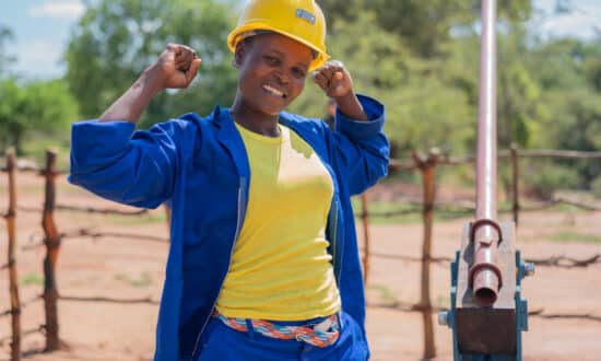
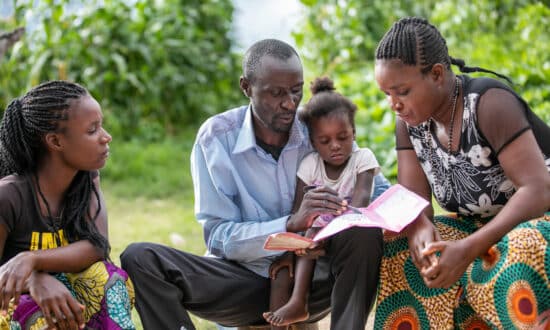
Disaster Risk Management and Response
Country Description
Tuvalu is a small, isolated island country in Oceania, about halfway between Hawaii and Australia. It is composed of three reef islands and six atolls. It has a tropical climate and high average annual precipitation; however, this is highly variable year to year. Its highest elevation is 4.6m above sea level, which along with its exposure to cyclone-generated winds, storm surges, swells and rising sea level, makes Tuvalu vulnerable to climate change (World Bank Group, 2021). However, it is considered to be Low Risk by the World Risk Report (2023).
Projections for Tuvalu’s future rainfall and temperature vary due to limited data and its small spatial scale (World Bank Group, 2021). However, risks that it can face include the increased prevalence of heatwaves, intensified cyclones, saline intrusion, coastal erosion (IPCC, 2019), wave-driven flooding, and permanent inundation (ibid.). Furthermore, the country has limited soil, so it is heavily reliant on imports and fishing for food (ibid.). Overfishing and the effect of climate change on fisheries and biodiversity are expected to have a negative effect on healthy coral reefs (and thus, fish) (ibid.). Its freshwater supply is almost entirely dependent on rainfall, so meteorological droughts pose a large threat to its water security (ibid.). The IPCC (2014) warns, however, that many communities in Tuvalu and other island states are built (due to engineering works in WW2, rapid development, growth, etc.) in unsuitable areas such as on vulnerable shorelines or swamplands leaving the communities already in a heightened state of vulnerability that is not necessarily caused by, but rather exacerbated by climate change.
Among other projects, Tuvalu Coastal Adaptation Project, the Government of Tuvalu is working to reduce the impacts of climate change induced sea level rise on key infrastructure by implementing various projects including beach nourishment, concrete and rock revetments, and sea walls.
Country Description
Sri Lanka is a small island nation in the Indian Ocean, with a warm and humid climate influenced by its geographical position between 6°N and 10°N latitude. The country has four distinct climate seasons: the two monsoons—the southwest monsoon (Yala) from May to October and the northeast monsoon (Maha) from December to March, as well as two inter-monsoonal periods. The southwest monsoon brings heavy rainfall to the western, southern, and central highlands, while the northeast monsoon affects the northern and eastern regions (Climate Change Knowledge Portal). Average annual temperatures range between 28°C and 30°C in coastal areas and can drop to around 15°C in the central highlands. However, due to climate change, Sri Lanka is experiencing increasing temperatures, with projections indicating a rise of up to 3.5°C by 2100 under high-emission scenarios (World Bank Group).
Additionally, Sri Lanka is highly vulnerable to extreme weather events such as floods, droughts, landslides, and cyclones, which have intensified in recent decades. Sri Lanka experiences significant spatial and temporal variations in droughts and floods. Climate change is intensifying these challenges by increasing rainfall variability and extreme temperatures, leading to new risks such as salinity intrusion, coastal erosion, and sea level rise. The rising frequency and intensity of climate-induced disasters pose a growing threat to the country’s socioeconomic development. (Asian Development Bank).
In response, Sri Lanka has developed various adaptation and mitigation strategies, including commitments under its NDC (2021) to the Paris Agreement. These efforts focus on enhancing disaster resilience, promoting sustainable agriculture, improving water resource management, and transitioning to renewable energy sources.
Country Description
Senegal is a country that is vulnerable to the impacts of climate change from drought, locust invasion, flooding and related health epidemics, sea-level rise, coastal erosion and its corollaries, and bush fire (World Bank Climate Change Knowledge Portal). The country is considered highly vulnerable to recurring environmental shocks, with droughts and floods having intensified in recent years, and climate change is expected to further increase the extremes of weather patterns and natural hazards putting vulnerable populations such as the 50.8 percent of the population (8,579 thousand people in 2021) considered as multidimensionally poor, while an additional 18.2 percent is classified as vulnerable to multidimensional poverty (3,069 thousand people in 2021) (2023 Multidimensional Poverty index, UNDP). The adverse effects of the climate crisis disproportionately affect the poor, mainly through decreased agricultural productivity, increased food prices, coastal flooding and erosion, and associated health hazards, with female-headed households more economically vulnerable to even modest levels of climate change (World Bank Group Systematic Country Diagnostic of Senegal).
Country Description
Kiribati is an isolated, low-lying island nation in the central Pacific Ocean consisting of 32 island atolls and one coral island. Temperatures are highly stable across the islands throughout the year, however annual rainfall varies between the northern and southern islands (drier). It has a hot, humid, tropical climate 100% of its population live within 1km from the coast (Australian Aid, 2021) and it is almost completely reliant on imported food and fuel (World Bank Group, 2021).
Due to its low elevation and isolation, it may be one of the most vulnerable countries to climate change, however there is a lack of data on the country, which limits the accuracy of model projections (World Bank Group, 2021). Little is known about how temperature, precipitation, floods, droughts, and cyclones will change in the future. The country is almost entirely dependent on rainfall for its water supply which is vulnerable to saline contamination (ibid.). Sea level rise has already displaced some communities in Kiribati (ibid.), and many atoll islands are expected to be uninhabitable by the end of the century (Storlazzi et al., 2018).
Kiribati submitted an NDC in 2022 which they aim to strengthen governance, improve knowledge, green the private sector, increase water and food security, and strengthen health service delivery in response to climate change impacts, among other priorities.
Country Description
Burundi is a landlocked country located in the Great Lakes region of Africa. It is one of the smallest and least-developed countries in Africa. It has a population of 14 million people, and 78% of them live below the poverty line (African Development Bank).
Burundi is essentially an agricultural country, with crop production and animal husbandry contributing about half of the GDP. Climate change is projected to cause higher temperatures and more extreme rainfall that will affect largely the economy and people’s lives due to the heavy reliance on agriculture. Furthermore, poverty hinders people’s capacity to adapt to the changing climate (African Development Bank).
Extreme rainfall events may negatively affect access to safe water sources as well as hydropower production. Moreover, high urbanization rates combined with poverty create a special concern in urban settlements, in terms of the impacts of disasters and the provision of basic services (African Development Bank).
Country Description
Barbados, a small island nation within the Carribean region considered is highly vulnerable to the impacts of climate change. The country is vulnerable to hurricanes and natural hazards and is particularly susceptible to coastal inundation and sea level rise, which increase tidal and storm surge levels, coastal erosion, increasing temperatures, changes in rainfall patterns, cyclones, and droughts among others (World Bank Climate Change Knowledge Portal).
Barbados has also been noted as a country at the forefront of reforming the world of development finance, particularly how rich countries help poor countries cope with and adapt to climate change, through movements like the Bridgetown Initiative. (World Economic Forum)
Country Description
The Ivory Coast is a country in West Africa along the Atlantic Ocean. It is characterized by flat plains with higher mountains in the west. The coast has a tropical climate whilst the north is largely savannah. The Ivory Coast has among the highest rates of biodiversity globally, but also one of the highest rates of deforestation (PIK, n.d.). The Ivory Coast’s location, economic structure, and limited adaptive capacity make it one of the most vulnerable countries in the world to climate change (137/187 on the 2025 ND-GAIN Index).
Compared to pre-industrial levels, average temperatures in Ivory Coast are projected to increase between 1.7°C-3.7°C by 2080 (PIK, n.d.). Precipitation projections are uncertain, however future dry and wet periods are expected to become more extreme (ibid.). Sea level rise is expected to threaten coastal communities – the majority of the country’s 25 million people live along its coast – as well as water quality and availability due to saline intrusion (ibid.). Coastal fisheries are projected to see a 26% reduction by 2050 due to rising temperatures and the changes in rainfall patterns (among other factors) are expected to worsen water availability, soil quality, and importantly, cocoa yields (GRID Geneva, n.d.). Primarily subsistence-based and rain-fed agriculture is the backbone of the Ivory Coast’s economy and is at risk from rising temperatures and water insecurity. The agricultural sector has low adaptive capacity which underlies its vulnerability to climate change (World Bank Group, 2023).
GRID Geneva (n.d.) argues that there is strong political will in the Ivory Coast for climate action, however, much remains to be done in terms of operationalizing policies. The country faces challenges in terms of technical capacity, limited coordination, and insufficient mainstreaming of climate policies. The Ivory Coast’s REDD+ strategy aims to reduce deforestation, and it is working with the Cocoa and Forests Initiative to reduce the pressure of cocoa production on forests.
Country Description
Cuba is an archipelago that comprises the island of Cuba, the Isle of Youth and over 1,600 smaller islands and cays. With a population exceeding 11 million people (2020), Cuba is particularly vulnerable to the effects of climate variability. The country depends heavily on rainwater as its sole water resource, which makes it susceptible to changes in precipitation patterns. Rising temperatures also pose public health risks, including an increased prevalence of diseases such as dengue fever, diarrhea, chickenpox, and other viral infections. Additionally, Cuba faces challenges from rising sea levels, higher temperatures, and decreasing rainfall. Key sectors like agriculture, forestry and tourism are particularly at risk from these climatic changes (World Bank Climate Change Knowledge Portal).
Country Description
Zambia is a large, landlocked country in central-southern Africa. It has a predominantly sub-tropical with one wet rainy season and two dry seasons, though rainfall varies significantly across the country. Its economy is predominantly based on the exploitation of its natural resources. Its climate is highly variable with droughts, floods, and extreme temperatures being increasingly frequent and intense in the past decades.
Zambia’s average annual temperature is expected to increase between 1.2˚C –3.4˚C by 2060 compared to pre-industrial levels depending on the emission scenario (GRID Geneva, n.d.). Coupled with nearly annual drought or flood episodes since 2000, Zambia has experienced a reduction in rainfall between 1971-2005 compared to 1940-1970, with its southwestern region most severely affected (ibid.). Water availability is projected to decrease by 13% by 2100 which will have severe consequences for hydropower, agriculture, industrial production, and household use (NDC, 2020). Zambia already faces a high incidence rate of malaria, and this is expected to increase with climate change (GRID Geneva, n.d.). Waste management is a major concern for Zambia’s urban areas, with illegal dumping and open fires leading to both environmental degradation and increased risk of public health outbreaks (Sambo et al., 2020).
In Zambia’s NDC, it outlines its mitigation actions focusing on sustainable forest management, sustainable agriculture, and renewable energy and efficiency (NDC, 2020). Adaptation programs are related to the promotion of irrigation, strengthening early warning systems, and using GIS/remote sensing in mapping drought/flood prone areas (UNDP, n.d.).
Country Description
he country has the population of approximately 13.1 million people, with 81.8% resides in rural areas, primarily engaging in subsistence agriculture. The climate of South Sudan is similar to tropical climate with high rainfall season, followed by a drier season. Rainfall occurs in a single rainy season from March to November, peaking between May and September. While the southern and eastern parts receive higher rainfall, the country experiences significant climate variability. Consequently, droughts and floods frequently impact livelihoods, particularly in agriculture (Climate Change Knowledge Portal).
The country is highly vulnerable to climate risks, including rising temperatures, erratic rainfall, prolonged droughts, and severe flooding. Since the 1970s, average temperatures have increased by 1-1.5°C, with projections indicating further warming by 2060 (African Development Bank). These climate risks, combined with widespread displacement due to ongoing conflict, have intensified food insecurity, and increasing the risk of local conflicts.
To response to these challenges, South Sudan put the major priorities for actions and investments for climate change mitigation and adaptation strategies (USAID South Sudan Climate Vulnerability Profile). These are outlined in its NDC, focus on reducing greenhouse gas emissions through policies in energy, land use, and transport. The country estimates that at least $50 billion is required for mitigation and adaptation efforts by 2030. However, these estimates remain approximate, and further analysis is needed to refine support requirements.
Country Description
Laos, officially known as Lao People’s Democratic Republic (Lao PDR), is a landlocked country in Southeast Asia located in the Mekong River Basin. The country has diverse topography, with approximately 80% of the country’s land area is mountainous, and the remaining 20% is low lying plains. Laos has two distinct season: rainy season (monsoon) and dry season, experiencing high humidity and average temperature ranging from 15 to 35 in hot season. However, in recent years, the country has been experiencing higher climate risks with increased extreme weather events such as flooding, droughts and heatwaves, as well as changing rainfall patterns and higher temperatures. The country is amongst the most vulnerable countries to projected climate change trends with the communities facing severe climate-related hazards (World Bank Group, 2021).
These climate change impacts tend to affect the poorer and more marginalized communities, where agriculture serves as the primary source of livelihood. It is stated that many households have a high probability of falling into poverty when exposed to the increased extreme weather events (ADB, 2017). Accordingly, Lao PDR submitted their NDC in 2015 and resubmitted the updated version in 2021 with the main focus on climate change adaptation and mitigation in agriculture, forestry, land use, water resources, energy, transport, urban development and public health.
Country Description
Samoa is of volcanic origin and is located in the Pacific, making it one of the countries to be known as frequented by the occurrence of tropical cyclones that bring damaging winds, rains, and storm surges. There have also been historic events of impactful cyclones that caused extensive crop damage and prevented some of the large fishing vessels from going out to see, which is critical in the country’s economy since agriculture and fisheries are primary industries in the country (World Bank Climate Change Knowledge Portal). The projected sea level rise because of climate change are anticipated to exacerbate coastal erosion, the loss of land and property, and the displacement of island inhabitants (UNDP Climate Change Adaptation). As a small island country, Samoa has also been identified to have a high level of a lack of adaptive capacities related to developments in education and research, reduction of disparities, investment and disaster preparedness (World Risk Report 2024).
Country Description
Vietnam has both a tropical climate zone and a temperate climate zone, with all of the country experiencing the effects of the annual monsoon (Climate Risk Country Profile). In the country, climate impacts such as rising temperatures and changes in rainfall patterns that affect agricultural activity, and intensified extreme weather events, pose significant challenges to Vietnam’s economic and social development, particularly for vulnerable populations in coastal and rural areas. In recent years, water flows of main river basins have been lower than the average for many years. Prolonged heat and droughts increase the risk of arid soil, reducing soil quality, not to mention increased heat also increases the risk of forest fires. Historical loss and damage: Between 2011 and 2020, extreme climate events have caused severe economic damage, with total losses estimated at VND 229,958 billion (an equivalent of USD 10 billion at 2022 exchange rates). On average, Viet Nam suffers about USD 2.4 billion worth of direct damage in public and private property (equivalent to 0.8% of GDP) due to extreme weather events. (Climate Change Knowledge Portal)
With these conditions, Vietnam faces potentially significant social and economic impacts across multiple regions and sectors. Without effective adaptation and disaster risk reduction efforts multidimensional poverty and inequality are likely to increase. (Climate Risk Country Profile)
Country Description
Vanuatu is a country consisting of over 80 islands in the Malenesia region of Oceania. From rising temperatures to rising sea levels and resulting storm surges, Vanuatu faces the effects of a radically shifting climate, like its neighbors in the Pacific Region. The Department of Climate Change in Vanuatu has estimated that by 2030, temperatures will increase in Vanuatu by up to 1° Celsius (33.8° Fahrenheit) per year. Extreme rainfall events are predicted to grow in frequency and intensity, increasing the resulting damages spurred by cyclones, storm surges, landslides, flooding and droughts, while tropical cyclones are projected to be less frequent but will be more intense in future. (Department of Climate Change, Government of Vanuatu).
From 1993-2022, the Climate Risk Index ranked Vanuatu as 9th in terms of countries most affected by climate change. The existing vulnerabilities faced by women in the region also intersect with disaster risk, making women more susceptible during and after natural hazards. For countries like Vanuatu, the Solomon Islands, and Fiji, Tropical Cyclone Harold in 2020 resulted in the majority of women employed in the tourism industry and agriculture sector losing their jobs (UNESCAP Pathways to Adaptation and Resilience in Pacific SIDS). This ranking is also is owed to Vanuatu’s high number of relative economic losses, affected people, and relative fatalities. (Climate Risk Index) Being an island nation, the country has endured repeated cyclones that have been projected to worsen even more due to climate change.
Country Description
Tonga is an archipelago in the South Pacific consisting of 171 islands (45 of which are inhabited) in Polynesia. Many of the islands that make up Tonga originate from coral line, but some are volcanic, and several volcanos still exist along the western ridge of the country. Tonga’s climate is tropical and is markedly seasonal, with a dry season from May to October and a wet season from November to April. Tonga is vulnerable to climate change-driven extreme weather events, sea level rise, increases in temperature and precipitation, drought, flood, and coral bleaching.
The temperature in Tonga is projected to increase by the end of the century, however the future temperature rise in Tonga may be below the global average due to the proximity of the ocean (World Bank Group, 2021). As the World Bank Group (2021) notes, ocean cover can distort model simulations, and a higher level of spatial accuracy is needed to predict climate processes over small island states more reliably. Nonetheless, temperature on extremely hot days is projected to increase as well as the frequency of these days. Between 1979 and 2006 Tonga experienced an increase in mean precipitation however estimates for future scenarios are uncertain in precipitation, drought, heatwaves, floods, cyclones, and storm surge (ibid.), although Tonga already faces high risk from cyclones and storm surges. Tonga is almost entirely reliant on rainfall for its water supply, so it is vulnerable to changes in rainfall due to climate change (ibid.). Agriculture – which employs 1/3 of Tonga’s labor force and accounts for 50% of its exports – is also highly vulnerable to changes in rainfall (ibid.). It is likely that sea level rise in Tonga is going to continue to rise even more than historical data-based projections suggest (ibid.).
In Tonga’s Second NDC (2022) they outline their adaptation priorities as adapting to increases in temperature and sea level. Among other goals, Tonga has a goal of having 30% of land in Tonga used by agro-forestry or forestry by 2025, maintain existing socks of fish and other marine species, and prevent any permanent loss of land to rising sea levels on its four main islands.
Country Description
The Solomon Islands, an archipelago located in the Melanesian region of Pacific, south-east of Papua New Guineam, consists of over 900 islands spread across a vast maritime area. The country’s topography is diverse, featuring volcanic islands, atolls, mountains, and saltwater lagoons. It has a tropical climate, characterized by high temperatures, high humidity, and significant rainfall year-round, with a distinct wet season from November to April, often bringing cyclones and extreme weather events. The Solomon Islands is currently highly vulnerable to climate change due to the coastal geography and reliance on natural resources (World Bank Group). The country experiences increasing temperature, with the projected warming trends of 0.7 – 2.8°C by the end of 21st century. Furthermore, sea level rise also poses threat on submerging low-lying islands at a rate of faster than the global average. Extreme rainfall events and increasing frequency of natural disasters put the communities on high risks, particularly those dependent on subsistence agriculture and fisheries (Climate Knowledge Portal Country Profile).
In response to the challenges, the Solomon Islands has taken policy initiatives, including the Solomon Islands National Climate Change Policy (NCCP) 2023-2032 and Long Term Low Emission Development Strategy (LT- LEDS) and commitments under the Paris Agreement, with its Second Nationally Determined Contribution (NDC) submitted in 2016. Disaster risk reduction and adaptation efforts, such as mangrove and coral reef restoration, are also taken into action to mitigate the impacts of climate change on the communities and ecosystems (Climate Knowledge Portal Country Profile).
Country Description
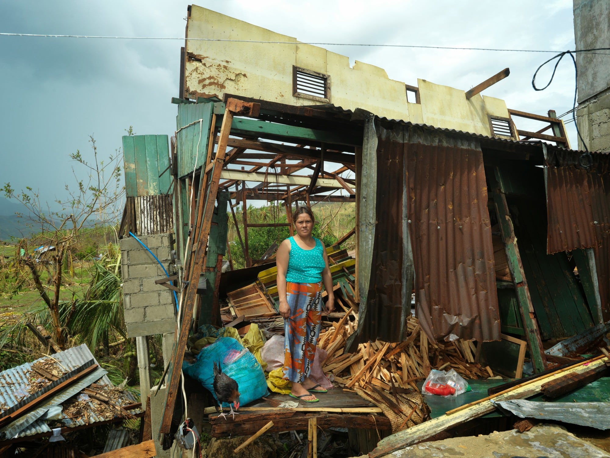
Located in the heart of Southeast Asia, the Philippines is found near the equator and within the Pacific Ring of Fire. Because of this geographic location, the Philippines is counted as one of the most vulnerable countries to various hydrometeorological disasters and ranks first among 193 countries assessed for disaster risk (World Risk Index 2024).
With the effects of the climate crisis, low-lying coastal communities are threatened by rising sea levels, while increasingly intense typhoons averaging at about 20 per year (Philippine Atmospheric, Geophysical and Astronomical Services Administration) bring devastating floods and landslides. Moreover, prolonged droughts and erratic rainfall patterns disrupt agriculture, water resources, and access to basic services. These climate impacts disproportionately affect marginalized communities, exacerbating poverty, increasing gender-based violence, and overall inequality. Complex and ever-changing socioeconomic conditions also make the country particularly susceptible to the intensifying effects of climate change.
Country Description
Country Description
Bangladesh has a humid, warm climate influenced by pre-monsoon, monsoon and post-monsoon circulations and frequently experiences heavy precipitation and tropical cyclones (World Bank Climate Change Knowledge Portal). In the World Risk Report, Bangladesh is 9th among 193 countries assessed for disaster risk (World Risk Index 2023).
In rural areas, where nearly 80 percent of the population live, climate change has an immediate and direct effect on the health and wellbeing of millions of people who depend on natural resources for their livelihoods. The impacts of climate change are also increasingly felt in large cities that are exposed to various climate-induced hazards, including variations in temperature, excessive and erratic rainfall, water logging, flooding, and heat and cold waves (Bangladesh: Finding It Difficult to Keep Cool as cited in Rabbani et al, 2011).
Country Description
Ecuador is middle-income country located in northwestern South America, with a population of approximately 17.5 million people. The climate varies significantly across its geographic regions, allowing for great biodiversity. Ecuador has abundant agricultural, oil, mineral, and hydropower resources; agriculture contributes to 32% of employment, while 77% of energy produced comes from hydropower sources. However, poverty remains at 27% and has shown little decrease in the last years (World Bank Group, 2024).
Ecuador is highly vulnerable to natural hazards, including floods, landslides, droughts, and earthquakes. El Niño and La Niña phenomena, are particularly harmful for the country, as they increase flood and drought risk. Climate projections suggest increasing mean temperatures in Ecuador, triggering more extreme weather events, like intense precipitation, which makes floods and landslides more prevalent. An estimated 20% of Ecuador’s population is exposed to 15 centimeters or more of flood inundation risk (World Bank Group, 2024).
Climate change impacts threaten income, infrastructure, and livelihoods. Natural disasters are expected to worsen with climate change, exacerbating hazards, and prolonged water shortages that affect hydroelectric power, particularly impacting the poor in the Amazon and coastal regions. Prolonged water shortages have already compromised hydroelectric power generation, as evidenced by the energy crisis in 2023 and April 2024. The lack of adaptation options will raise the risk of energy crises in the country and further jeopardize agricultural activities, as well as biodiversity (World Bank Group, 2024).
Country Description
Located on the southern edge of the Arabian Peninsula, Yemen is a predominantly arid sub-tropical country with average temperatures that vary depending on elevation and distance from the sea. To the west it borders the Red Sea and to the South the Gulf of Aden. More than half of Yemen is classified as a desert, and it has more than 112 islands in the Red Sea that are rich in mangroves and fisheries. Yemen’s ongoing humanitarian crises has left most of its population at risk of hunger, disease, insufficient water, and limited sanitation services (World Bank Group, 2024).
Extreme temperatures, floods, landslides, and droughts naturally occur in Yemen; however, climate change is expected to exacerbate the effects of these risks (World Bank Group, 2023). These factors, along with the ongoing conflict, recent natural disasters, and limited and destroyed infrastructure (among other factors) make Yemen the 10th most vulnerable country in the world according to the World Risk Report (2023). The IOM (2021) argues that rising sea levels mean that existing issues around water availability and quality are exacerbated by rising sea levels that have increased the salinity of aquifers near the coast. Further climate threats Yemen is expected to face include more frequent droughts, land degradation, reduced agricultural outputs, and the proliferation of vector- and waterborne diseases.
According to the UNDP (2023) efforts to address the effects of climate change in Yemen hinge on efforts to reach a peaceful end to the ongoing conflict and to improve the country’s food and water security.
Country Description
Zimbabwe is a landlocked country in southeast Africa. Most of the country lies on a high central plateau with mountains in the east. Zimbabwe has a predominantly subtropical climate, but the south is known for its extreme heat, whilst the eastern highlands have cooler temperatures. Zimbabwe is considered to have high vulnerability and a very high lack of adaptive capacity according to the 2023 World Risk Index.
The key climate change impacts expected in Zimbabwe are water- and food-security related, as well as the health impacts from vector and waterborne diseases (UNDP, n.d.). Between 1970 and 2016 Zimbabwe’s mean annual temperature increased about 0.3˚C per year (World Bank Group, 2021). Zimbabwe’s temperature is expected to increase between 1˚C -1.5˚C by 2040 from a 1986-2005 baseline, depending on the emission scenario (ibid.). Average rainfall is projected to decrease by 10% in this period, however, there is more uncertainty with these estimates (GRID Geneva, n.d.). At the same time, intense rainfall leading to flooding is expected to increase. 80% of agriculture – accounting for 67% of total employment in the country – is rainfed, making it one of the sectors most vulnerable to the effects of climate change (World Bank Group, 2021). By 2050, Zimbabwe is projected to have a 38% decrease in national water availability per capita because of climate change which is expected to have severe knock-on effects for agriculture, power generation, health, tourism, and the country’s wildlife species (ibid.).
Zimbabwe has submitted the third version of its NDC with a plan for 2025-2035 (Government of Zimbabwe, 2025) in which it outlines that adaptation is its policy goal for the next decade. Zimbabwe is implementing various projects with national and international funding. Along with the Green Climate Fund Zimbabwe is focusing on projects related to Renewable Energy, Integrated Waste Management, Forestry, Agriculture, and DRR (Government of Zimbabwe, 2021).
Country Description
Malawi is a landlocked country in the southern part of Africa, bordered by Tanzania, Mozambique, and Zambia. The country has a diverse topography, with one of the most significant geographical features is Lake Malawi, the third-largest lake in Africa. Other than that, the country’s topography consists of high, well-watered plateaus broken by large hills (World Bank Group, 2021).
Malawi has a subtropical climate, characterized by two seasons: rain season from November to April, and dry season from May to October. The country experiences high temperature and humidity, with different range of temperature depending on the region and season. However, recently the country has experienced increased in frequency of climate change impacts including erratic rainfall, droughts, prolonged dry spells and strong winds. These changes has impacted on various sectors of the economy such as agriculture, health, water, energy, transport, education, gender, forestry, wildlife and infrastructure. Consequently, as the majority of Malawians rely on small-scale, rain-fed agriculture, the communities are highly dependent on the weather patterns. This makes the communities even more susceptible to extreme weather events (Irish Aid, 2018).
Recognizing the challenges, the Government of Malawi has initiated adaptation and mitigation measures and strategies including Malawi 2063, which emphasizes environmental sustainability as one of the most cross-cutting factors. Furthermore, Malawi submitted their NDC with the unconditional and conditional contribution of 51% reduction in GHG emissions by 2040 across the three pillars: (i) institutional framework, (ii) knowledge, technology and financing and (iii) resilience of the most vulnerable.
Country Description
Madagascar, the fifth largest island in the world, is located just off the southern edge of the African continent in the Indian Ocean. The country’s diverse topography, including coastal plains, high plateaus and mountain ranges, contribute to its varied climate conditions. Madagascar’s climate varies by region: the southwest has a semi-arid to arid climate, the eastern coast experiences a tropical climate, and the central highlands have moderate temperatures and moisture levels. The arid conditions in the southwest result from trade winds from the Indian Ocean, which lose their moisture over the eastern coast and highlands, creating a rain shadow effect in the western part of the country (World Bank Group, 2021).
In recent years, the country has been facing increasing range of climate hazards such as tropical cyclones, droughts, floods, and rising sea levels. These impacts have profound effects on the country’s key sectors such as agriculture, infrastructure, water and sanitation, health, education, and increasing the poverty rate (Miklyaev & Olubamiro, 2025). For instance, the agricultural sector, which employs approximately 80% of the population, is greatly affected by the heavy rainfall and extreme weather events, leading to the crop losses and food insecurity. To address these challenges, Madagascar submitted their NDC in 2022, with details on various adaptation strategies and policies such as enhancing agricultural resilience and improving water resource management.
Country Description
Niger is a landlocked country in Western Africa, belonging to the Sahel region. Characterized by its location within the said region, the country is exposed to a hot and dry climate with significant variability in rainfall. The said region, encompassing around 80% of the Niger’s land area, has a “high dependence on rain-fed agriculture and its natural resources to support food security and livelihoods, rapid population growth, and chronic humanitarian crises due to recurrent drought, flooding, food insecurity, epidemics, and violent conflict. The country has shown history of droughts and flooding.” (Climate Change Knowledge Portal). According to the Federal Ministry for Economic Cooperation and Development, temperature in Niger is projected to rise by between 2.0 and 4.6 °C by 2080, compared to pre-industrial levels, with higher temperatures and more temperature extremes projected for the south-west of Niger.
Given these compounding factors, climate change will likely exacerbate existing vulnerabilities in the country. Water scarcity, longer dry seasons and impacts of higher temperatures may trigger new conflict and forced migration, issues that already impact the region. (USAID Climate Risk Profile, 2017).
Country Description
Mali, officially known as the Republic of Mali, is one of the largest countries in West Africa. The country is landlocked, sharing border with seven countries: Algeria, Mauritania, Niger, Burkina, Faso, Ivory Coast, Guinea and Senegal. It is known to be one of the hottest countries in the world, with most parts the country has desert or semi-desert climate, except for the far south-west region with more tropical wet dry climate. Rainfall varies significantly across the country, decreasing from south to north, with the northern region receiving minimal precipitation during the boreal summer. Temperatures remain consistently high, with large variations between day and night, as well as between seasons, especially in the northern areas (African Development Bank Group).
In recent years, Mali has faced increasing climate risks, including rising temperatures, erratic rainfall, prolonged droughts, and desertification (World Bank Group). As the majority of cereal crops in Mali are rain-fed, which are vulnerable to rainfall variability, these climate change impacts can threaten both livelihoods and food security. Additionally, the country is among the least developed countries in the world, with 44% of the population is below the poverty line (World Bank). To face these challenges, Mali updated their NDC in 2021, with the key highlights on emission reduction targets by 2030, increased commitment compared to 2015 submission, gender integration to align with Sustainable Development Goals, and including detailed monitoring and reporting framework (UNDP). It also strengthens adaptation measures across key sectors such as agriculture, forestry, water resources, and energy, and introduces decentralized climate funds to support community-led resilience initiatives.
Country Description
Cameroon is a tropical climate country located in the western part of Central Africa, bordering the Atlantic Ocean. It has a population of 26.6 million people and is considered a lower-middle-income country. In terms of contribution to the GDP, Cameroon’s economy is dominated by the services sector, followed by the industry; however, agriculture is the primary means of livelihood and employs 44 % of the working population (GIZ Climate Risk Profile).
With climate change, temperature and annual precipitation are projected to rise. This will affect water availability, particularly in northern Cameroon, but will also cause more frequent and intense flooding that could severely impact the infrastructure sector. On top of that, sea level is expected to rise to 39 cm, threatening Cameroon’s coastal communities. As agricultural production is subsistence-based and rainfed, it is particularly vulnerable to precipitation changes, and extra environmental challenges, like deforestation and overgrazing, further threaten this activity (GIZ Climate Risk Profile).
Present in Cameroon since 1978, CARE Cameroon has a long history of working on agriculture, natural resource management, and climate change adaptation, and is present in six of the country’s ten regions. In Cameroon, CARE works in three main areas: (1) effective, sustainable and inclusive economic development for youth and women, including climate change; (2) the right to accessible and quality health services; and (3) early recovery from humanitarian crisis situations.
Country Description
Benin, located in West Africa along the Guinea Coast, has a population of 13.7 million. Its mostly flat terrain features two major river basins, the Niger and the coastal basin (World Bank Climate Change Knowledge Portal). The country experiences two main climates: a sub-equatorial climate in the south and a tropical continental climate in the north. Key climate risks include drought, flooding, heavy rains, high winds, extreme heat, and sea-level rise. Over the past three decades, these hazards have caused reduced agricultural yields, disrupted farming calendars, lower dam water levels, prolonged dry seasons, and riverbank submersion (Benin’s NDCs 2015).
Future impacts may include coastal flooding, saltwater intrusion, declining maize yields, and shifts in flooding patterns in the Niger basin (Benin’s NDC’s 2015). Climate change is likely to worsen existing challenges, particularly in agriculture and health. With 70% of the workforce dependent on agriculture, Benin’s undiversified economy is highly vulnerable. Poverty affects 35% of the population, compounded by limited access to basic services such as healthcare, education, and sanitation (World Bank Climate Change Knowledge Portal).
CARE International has been active in the Republic of Benin since 1999. CARE is known for its interventions in the fields of education, health and the environment, including issues related to natural resources and climate change management; sustainable livelihoods, such as microfinance and agriculture; Water, Sanitation & Hygiene (WASH); promotion and protection of the rights of women and children; as well as emergencies.
Country Description
Tanzania is the largest country in east Africa with a coastline along the Indian Ocean. Tanzania is predominantly a highland area sitting 900-1800m above sea level with mountains ranges throughout, except by the coast where it is flatter. Tanzania’s climate is largely driven by altitude, with tropical lowlands in the east to colder highlands in the north and southwest. It is vulnerable to the effects of climate change in public health, energy supply, infrastructure, water resources, and agriculture (World Bank Group, n.d.). Climate change is expected to exacerbate the risks from extreme weather events such as variation in rainfall and frequent and prolonged droughts and floods (ibid.).
Air temperature in Tanzania is expected to rise across all emission scenarios, with the annual number of very hot days projected to rise substantially with high certainty (GIZ, 2021). Sea level rise threatens communities along the coast and may cause saline intrusion, threatening water supply and biodiversity (ibid.). Projections on precipitation vary with some models projecting a large decrease (>42mm by 2080 compared to 2000) whilst others suggest almost no change (ibid.). However, heavy precipitation events are expected to become more intense (ibid.). Water availability is predicted to decline by 76% under both RCP2.6 and RCP6.0, though this is region-specific (ibid.). Changes in waterflows have impacted the country’s capacity to generate and supply electricity, particularly hydropower, which has been directly attributed to climate change driven droughts (United Republic of Tanzania, 2007).
In its first NDC (2021) Tanzania outlines its adaptation measures in various sectors such as forestry (e.g. enhancing participatory sustainable forest management), coastal, marine environments and fisheries (e.g., promoting livelihood diversification for coastal communities), and energy (e.g., promoting climate-smart rural electrification).
Country Description
Uganda is a land-locked country located in East Africa. The Climate Change Knowledge Portal has noted that in past decades, the country has experienced “more erratic rainfalls leading to frequent busting of rivers, mudslides and landslides that lead to loss of lives and property of communities especially those living in the mountainous areas.” Previously known to have a tropical climate with stable rainfall patterns, the effects of climate change have affected the regularity of the seasons with the country experiencing shorter or longer rains and harsher droughts – especially in the eastern and north-eastern Uganda (IOM Uganda).
The Climate Change Department of the Ministry of Water & Environment of Uganda, with the main objective to strengthen Uganda’s implementation of the United Nations Framework Convention on Climate Change (UNFCCC) and its Kyoto Protocol (KP), identified four sections of focus for their government-led climate action: adaptation, mitigation, outreach, and international relations. Even with the substantial strides made in developing climate adaptation governance systems across Africa over the last decade, actual implementation remains a significant hurdle. The primary obstacles are the lack of effective collaboration between government agencies and the insufficient connection between national, district, and community stakeholders (Institutional challenges to climate change adaptation: A case study on policy action gaps in Uganda, 2017, E. L. Ampaire, et.al). Given its close connection to climate-dependent resources, Uganda faces severe climate vulnerability. The projected changes, such as heightened food insecurity, disease expansion, soil erosion, and flood-related damage, risk undermining the country’s development achievements (Relief Web, 2008).
Country Description
Somalia, officially known as the Federal Republic of Somalia, is located in the Horn of Africa, bordering Djibouti to the northwest, Ethiopia to the west and Kenya to the southwest. It has the longest coastline of all African states, stretching over 3025 km. The country has the majority classified as semi-arid or arid climate, with the topography characterised by mountainous terrain in the north, and mostly flat plateaus in the south (African Development Bank). The temperatures are hot, and rainfall is highly variable with two rainy seasons – the long rains (March-May) associated with southwest monsoons, and short rains (October – November) with northeast monsoons.
Somalia is facing risk due to several natural hazards, including drought, floods, cyclones, and climate-related diseases (World Bank Group). Additionally, the increase in rainfall can be associated with the increase in rainfall events and extreme intensity of rainfall. These challenges threaten key sectors such as agriculture, which employs 70% of the workforce, as well as water security, infrastructure, and coastal settlements (Adelphi – Climate Risk Profile).
With a large portion of the population highly vulnerable to climate risks, Somalia submitted their NDC (2021) emphasize adaptation strategies such as disaster risk reduction, improved water management, and sustainable land use practices to build resilience and ensure long-term stability.
Country Description
Ethiopia is a landlocked country in the Horn of Africa with a highly diverse climate due to its varied landscapes (rainforests in the south and southwest and deserts in the east, northeast, and southeast lowlands) (CCE Country Profile). It exhibits a high variability in precipitation between areas of high and low elevation (GIZ, 2021). Its average temperature has increased by an average of 1°C since the 1960s (World Bank, 2021) and air temperature is expected to increase between 1.6-3.7°C relative to pre-industrial levels by 2080 (GIZ, 2021).
Ethiopia has one of the fastest growing and poorest (rGDP pc USD570 in 2018) populations in the world (GIZ, 2021). 73% of the population is engaged in the agricultural sector and is reliant on subsistence-based and rain-fed agriculture for food security and livelihoods (ibid.). These factors exacerbate vulnerability to the high degree of risk from hydrometeorological hazards and disasters (World Bank, 2021) Ethiopia is subject to, along with climate change-driven threats including declining water availability, reduced food security, and increased frequency and severity of droughts and floods. Tensions between agricultural, livestock, and human population demands for water are expected to increase in the coming years as seasonal rainfall becomes more variable (World Bank, 2021).
Ethiopia is focusing on projects to improve crop and livestock production practices in an attempt to increase food security and farmer income as well as to increase its watershed capacity fourfold by 2030 (from 2018 baseline) (Nationally Determined Contribution 2021).
EXPLORE
Other Themes